Country exposure · BV
Bouvet Island
Antarctica
What Bouvet Island means for your money, the prices you pay, the tariffs in motion, and where U.S. policy could change both.
U.S. exposure
Minimal direct economic exposure
Bouvet Island is not a significant U.S. goods-trade partner and has no tracked tariff actions. Policy changes here are unlikely to reach American prices directly.
Reference
The country itself
Antarctica · Geography, people, economy, and government, public-domain data from the CIA World Factbook.
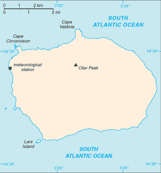
This uninhabited volcanic island in Antarctica is almost entirely covered by glaciers, making it difficult to approach. Bouvet Island is recognized as the most remote island on Earth because it is furthest from any other point of land (1,639 km from Antarctica). The island was named after the French naval officer who discovered it in 1739, although no country laid claim to it until 1825, when the British flag was raised. A few expeditions visited the island in the late 19th century. In 1929, the UK waived its claim in favor of Norway, which had occupied the island two years previously. In 1971, Norway designated Bouvet Island and the adjacent territorial waters as a nature reserve. Since 1977, Norway has run an automated meteorological station and studied foraging strategies and distribution of fur seals and penguins on the island. In 2006, an earthquake weakened the station's foundation, causing it to be blown out to sea in a winter storm. Norway erected a new research station in 2014 that can hold six people for periods of two to four months.
Geography
- Location
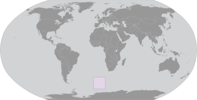
- island in the South Atlantic Ocean, southwest of the Cape of Good Hope (South Africa)
- Area
- 49 sq km
- Climate
- antarctic
- Terrain
- volcanic; coast is mostly inaccessible
- Natural resources
- none
- Coastline
- 29.6 km
- Natural hazards
- occasional volcanism, rock slides; harsh climate, surrounded by pack ice in winter
People & society
- Population
- uninhabited
Full reference data
Every field, by section, CIA World Factbook. Open a topic to expand it.