Country exposure · DX
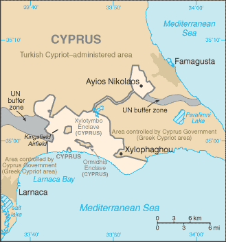
Dhekelia
Europe · Episkopi Cantonment (base administrative center for Akrotiri and Dhekelia); located in Akrotiri
What Dhekelia means for your money, the prices you pay, the tariffs in motion, and where U.S. policy could change both.
16K
Population
U.S. exposure
Minimal direct economic exposure
Dhekelia is not a significant U.S. goods-trade partner and has no tracked tariff actions. Policy changes here are unlikely to reach American prices directly.
Reference
The country itself
Europe · Geography, people, economy, and government, public-domain data from the CIA World Factbook.
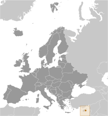
By terms of the 1960 Treaty of Establishment that created the independent Republic of Cyprus, the UK retained full sovereignty and jurisdiction over two areas of almost 254 square kilometers -- Akrotiri and Dhekelia. The larger of these is the Dhekelia Sovereign Base Area, which is also referred to as the Eastern Sovereign Base Area.
Geography
- Location
- Eastern Mediterranean, on the southeast coast of Cyprus near Famagusta
- Area
- 131 sq km
- Climate
- temperate; Mediterranean with hot, dry summers and cool winters
- Coastline
- 27.5 km
People & society
- Population
- approximately 15,500 on the Sovereign Base Areas of Akrotiri and Dhekelia including 9,700 Cypriots and 5,800 Service and UK-based contract personnel and dependents
- Languages
- English, Greek
Economy
- Industries
- none
Government
- Capital
- Episkopi Cantonment (base administrative center for Akrotiri and Dhekelia); located in Akrotiri
- Constitution
- presented 3 August 1960, effective 16 August 1960 (The Sovereign Base Areas of Akrotiri and Dhekelia Order in Council 1960, serves as a basic legal document); amended 1966
- Executive branch
- King CHARLES III (since 8 September 2022)
Full reference data
Every field, by section, CIA World Factbook. Open a topic to expand it.