Country exposure · GEC-SX
South Georgia and South Sandwich Islands
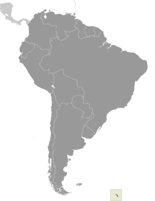
South America
What South Georgia and South Sandwich Islands means for your money, the prices you pay, the tariffs in motion, and where U.S. policy could change both.
U.S. exposure
Minimal direct economic exposure
South Georgia and South Sandwich Islands is not a significant U.S. goods-trade partner and has no tracked tariff actions. Policy changes here are unlikely to reach American prices directly.
Reference
The country itself
South America · Geography, people, economy, and government, public-domain data from the CIA World Factbook.
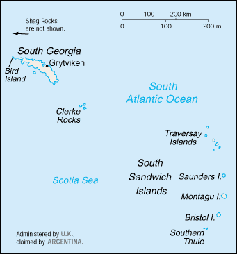
South Georgia and the South Sandwich Islands lie approximately 1,000 km east of the Falkland Islands and have been under British administration since 1908 -- except for a brief period in 1982 when Argentina occupied them. Grytviken, on South Georgia, was a 19th- and early 20th-century whaling station. Famed explorer Ernest SHACKLETON stopped there in 1914 en route to his ill-fated attempt to cross Antarctica on foot. He returned some 20 months later with a few companions in a small boat and arranged a successful rescue for the rest of his crew, which was stranded off the Antarctic Peninsula. He died in 1922 on a subsequent expedition and is buried in Grytviken. Today, the station houses scientists from the British Antarctic Survey. Recognizing the importance of preserving the marine stocks in adjacent waters, the UK extended the exclusive fishing zone in 1993, from 12 nm to 200 nm around each island.
Geography
- Location
- Southern South America, islands in the South Atlantic Ocean, east of the tip of South America
- Area
- 3,903 sq km
- Climate
- variable, with mostly westerly winds throughout the year interspersed with periods of calm; nearly all precipitation falls as snow
- Terrain
- most of the islands are rugged and mountainous rising steeply from the sea; South Georgia is largely barren with steep, glacier-covered mountains; the South Sandwich Islands are of volcanic origin with some active volcanoes
- Natural resources
- fish
- Coastline
- NA
- Natural hazards
- the South Sandwich Islands have prevailing weather conditions that generally make them difficult to approach by ship; they are also subject to active volcanism
People & society
- Population
- no permanent inhabitants
Full reference data
Every field, by section, CIA World Factbook. Open a topic to expand it.