Country exposure · HM

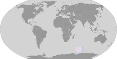
Heard Island and McDonald Islands
Antarctica
What Heard Island and McDonald Islands means for your money, the prices you pay, the tariffs in motion, and where U.S. policy could change both.
U.S. exposure
Minimal direct economic exposure
Heard Island and McDonald Islands is not a significant U.S. goods-trade partner and has no tracked tariff actions. Policy changes here are unlikely to reach American prices directly.
Reference
The country itself
Antarctica · Geography, people, economy, and government, public-domain data from the CIA World Factbook.
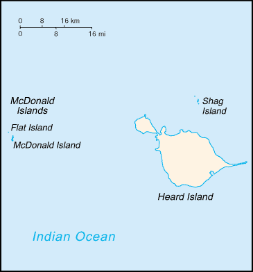
American sailor John HEARD discovered Heard Island in 1853 while fellow American William MCDONALD discovered the McDonald Islands the following year. Starting in 1855, sealers lived on the islands and harvested elephant seal oil; by the time the practice was ended in 1877, most of the islands’ seals were killed. The UK formally claimed the islands in 1910, and Australian explorer Douglas MAWSON visited Heard Island in 1929. In 1947, the UK transferred the islands to Australia for its Antarctica research, but Australia closed the research station on Heard Island in 1954 when it opened a new research station on the Antarctic continent. McDonald Island has been an active volcano since it emerged from dormancy in 1992, and the island doubled in size after an eruption in 1996. In 1997, the islands were named a UNESCO World Heritage site. Populated by a large number of bird species, seals, and penguins, the islands are primarily used for research, with limited fishing permitted in the surrounding waters.
Geography
- Location
- islands in the Indian Ocean, about two-thirds of the way from Madagascar to Antarctica
- Area
- 412 sq km
- Climate
- antarctic
- Terrain
- Heard Island - 80% ice-covered, bleak and mountainous, dominated by a large massif (Big Ben) and an active volcano (Mawson Peak); McDonald Islands - small and rocky
- Natural resources
- fish
- Coastline
- 101.9 km
- Natural hazards
- Mawson Peak, an active volcano, is on Heard Island
People & society
- Population
- uninhabited
Full reference data
Every field, by section, CIA World Factbook. Open a topic to expand it.